New features:
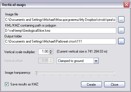
Vertical mapper tools. Creates a vertical map on the basis of images and KML file that contains the path or polygon.
Examples
http://blog.geoblogspot.com/2010/01/vertical-geological-map-of-main-shaft.html
http://blog.geoblogspot.com/2010/01/vertical-map-in-ge.html
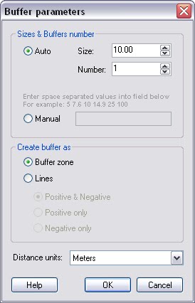
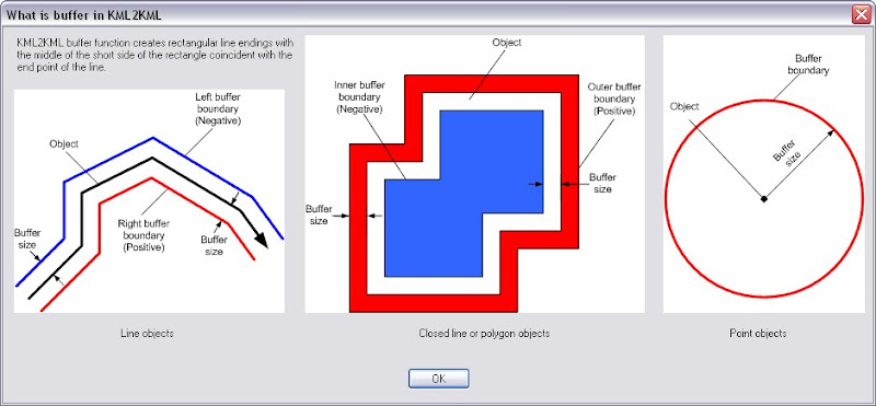
Buffer tool features is improved
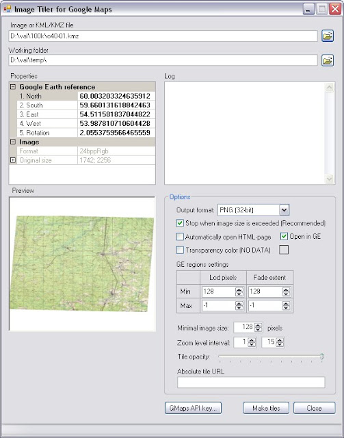
GMaps tiler tool features is improved
Examples
GMap tiles - http://mapinaction.appspot.com/Event.html?k=agttYXBpbmFjdGlvbnIOCxIGUmVjb3JkGKSZAQw -
GE KML - http://dl.dropbox.com/u/470962/kml/tiles/o-39-108/o-39-108-url.kml
Create Screenoverlay
The tool for creating Google Earth screen overlays

| License | Standard | Plus | Pro |
| Import (except shp) | x | x | x |
| Import (include shp) | x | x | |
| GMaps Tiler Improved! | x | x | x |
| Create Screenoverlay New! | x | x | x |
| Vertical mapper New! | x | x | x |
| Regions | x | x | x |
| Assembly | x | x | x |
| Distribute | x | x | x |
| Reorganize | x | x | x |
| Photo track | x | x | |
| 3D Surface | x | x | |
| KML to 3D | x | x | |
| Superoverlay PRO | x |


