1/30/2007

Isoliner 1.5.19


New version of Isoliner use Net 2.0.
We include also extension Slide Analyst into Isoliner as free function.
Now you can create isolines direct by grid or other slides of density.

ArcGIS 9.2. Test of extensions. Day 3

We use next order of setup:
1. Remove all additional extensions ( Typeconvert , KMLer , Geoselect , Isoliner , Slice 3D )
2. Remove ArcGIS 9.1
3. Setup ArcGIS 9.2
4. Setup of KMLer and Isoliner do not have of problems. By tests of all functions we see fine results. We not see of problems by work Isoliner with rasters.
5. For Slice 3D Typeconvert and Geoselect need Net 1.1. Setup of this extensions on ArcGIS 9.2 have now problems. We think adapt this extensions to Net 2.0 in near time.

1/25/2007

Gardens of the stones.


It is my old works with salt companies.
The task was of investigating the geometry of ore particles. I used the digital camera, which it adapted to the microscope. It consecutively a measuring standard and a series of ore particles. After this, we with the geologist carried out the classification of particles and calculated the areas and the content of different minerals. Besides the chemical analog of the content of components we see also their distribution. Cost of this devices is very low. We can use this in fields, in underground area, in the real time on the conveyor of chemical production.
After this experience i nice to ideas by David Riallant Pict'Earth blog in one second.

Full sets of images have more 3Gb.
Part of this photos you can see in flickr collections:
1 , 2 , 3 , 4 , 5 , 6

1/24/2007

ArcGIS 9.2. Test of extensions. Day 2

Test part of functions Slice 3D and Typeconvert is ok. I can convert graphics to features.
While i see problems with raster operations only.

In Visual studio i see next features also.

1/23/2007

ArcGIS 9.2. Test of extensions.

We receive queries about work our extensions with ArcGIS 9.2. Now i have this software and began make first tests.
First software:
ArcGIS 9.1 with Net support, Net 1.1, Net 2.0
All extensions from list.
Part of extensions (Typeconvert, Geoselect, Isoliner, Slice3D) work with Net 1.1
Part of extensions (KMLer, Slide Analyst) work with Net 2.0
My steps:
1. Remove ArcGIS 9.1
2. Install ArcGIS 9.2 with Net support and SP1.
3. Open ArcGIS. See all old registrations of extensions.
4. Test Typeconvert 2.3.6, KMLer 1.4.0 and Geoselect 3.0.1 is Ok. I can convert polygon to polyline, convert to KML and public project.
5. With Slide Analyst 0.1.0 now problem. I not can run this and not can remove from computer.
6. Part functions of Isoliner 1.0.8 now not work. It is functions of raster generation. Mesh generation is ok. You can while not use raster generation. Same results you can see with points (mesh) generation. We add now Slide Analyst as free function of Isoliner, move Isoliner to Net 2.0. Next steps it is adapt Isoliner to ArcGIS 9.2.

As base results i while see simple recomendations:
- not need remove and reinstall extensions.
It is first test. In next days i write about next results.

1/22/2007

New Pict'Earth blog!


New Pict'Earth blog!

We (i and David Riallant) began now partnership.
We have ideas make professional solution on base of Pict'Earth hardware system and new Pict'Earth software system.

Images in this post it is first results of Superoverlay generation gataset by Pict'Earth.

Network link to superoverlay.
Load and double click Network link please.

1/18/2007

Isoliner 1.0.8 New structure of dialogues. Part.2

Create triangulation.


Interpolation

By raster


By triangulation


By mesh (grid of points)

Isoliner 1.0.8 New structure of dialogues. Part.1

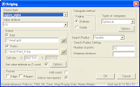
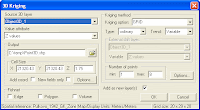
Kriging.

Create GRID and points feature class (mesh) by selected source layer and Z attribute.

How Kriging works.
Kriging is an advanced geostatistical procedure that generates an estimated surface from a scattered set of points with z values. Unlike the other interpolation methods, Kriging involves an interactive investigation of the spatial behavior of the phenomenon represented by the z values before the user selects the best estimation method for generating the output surface.

2D Kriging


2D Feature Kriging


3D Kriging


3D feature Kriging


3D Surface

Isoliner 1.0.8 New structure of menu.

New version of Isoliner. Menu structure.
Isoliner now have new structure of commands and user interfaces.

Main menu


Interpolation by


Create


Convert


Import


Add-Ins

1/16/2007

Isoliner 1.0.7


New version of Isoliner. Isoliner is the ArcGIS extension for make grids and points theme with interpolate by Kriging's and triangulation method. Isoliner include additional 3D functions, interpolation by features, generation of random points.
Full gallery of images.

Large updates. Change structure of functions and license.

2D Kriging - free
2D Feature Kriging - free
3D Kriging - plus
3D Feature Kriging - plus
Interpolation By Raster - free
Interpolation By Mesh - plus
Interpolation By Triangulation - pro
3D Surface - pro
Create Triangulation - pro
Create Section - pro
Create Section By Plane - plus
Create Section By Profile - plus
Create track - plus
Convert Objects To 3D - free
Convert Raster To Points - free
Convert Mesh To Triangulation - pro
Import Objects To Mesh - plus
Import Objects To Voxel Mesh - pro
Random Points - free
3D Random Points - free
Random Point in Ellipse - free


Price: Standard / Plus / Pro versions - USD Free / 50 / 150

1/15/2007

Superoverlay 1.5.5


Superoverlay version 1.5.5
Fixed bug with rotation of hi-res images.
Now results of rotation see fine.

We place example of image on
http://gis-center.org/kml/test/duas/BDE00100.454.kmz
Credits by
Linomar

You can download file and double click on network link.
Size of example near 4Mb. We place all tiled images into one file as presentation
(use option Packing into KMZ - "pack into one "). For real works this option not need.

1/12/2007

Superoverlay.1.5.4

Superoverlay version 1.5.4

New features:
- 'Convert to 8-bit PNG' is now available ('convert to 8 bit' algorithm is improved)
Speed of work with 8 bit images now very fast.
- 'Invert black to white' option is added (useful for inverting black background to white). You can set white color as transparency and black as white for best show of labels and grid.

Improved features:
- full import of Groundoverlay parameters by add KML ( KMZ ) - altitude, timer tags, transparency, georeference.

We adapt Superoverlay to works with standard topomaps, geological and other thematic maps. If your map have small count of colors then you can use:
- 8bit output (png)
- transparency white color for remove background
- "invert black to white" option for see labels and grid in white color.
Google Eart support transparency in PNG files. 8bit PNG files have small size and see as optimal solution for standards maps.

1/08/2007

Superoverlay 1.5.3

Next version of Superoverlay.

New features:
Full FTP upload
- user/password
- create of folders

Bug with "one pixel" fixed. Check please this!
Bug with Out of memory for small images fixed. Check please also!

1/07/2007

Real time Hi-res Images for Google Earth

Frank Taylor (Google Earth blog) place very nice information about new technology of data mining.

For this and near technologies we make program Superoverlay

I add to post full text and comment by David Riallant

GEarth blog.
===============
Watch Remote Control Plane with Camera Capturing Real-time Images for Google Earth

Check out this really cool video showing a guy launching a small unmanned remote control aerial vehicle with a digital camera used to capture images and then show the images in Google Earth.

Video 1

Video 2

The company Pict'Earth, has released these videos on their web site. The guy can view the images in real-time with VR goggles. Later, the images can be shown in Google Earth. This has got to be one of the cooler things I've seen done with Google Earth! And, there are some real practical uses of this technology. Google should take note. This technology could be a much less expensive way to acquire very-high-res data for certain situations - particularly for special events.

===========

I add to post full text of comment by David Riallant
----------------------
From PictEarth staff
Hello we have been working on PictEarth for more than a year now.
First of all to answer technical questions : there is one video camera (low res) with images streamed down real time to the ground. This is what we use for live update. But a digital camera shoots 7 - 9 megapix images at the same time. In post process we get images from the camera. With these images we can go as low as 3 cm resolution.
Second point : we get a very good mosaic but for fine results images can be post processed. This has been our job for the past 5 years so we know what we are doing...
We can provide the full packaged solution : from the UAVs to the video goggles, software, fine correction services... to meet your exact needs.
We have worked so far on many applications : agriculture, archeology, indistrial areas, road surveillance...
If you have to fly bigger areas, we also offer a regular plane platform but often projects fit into the UAVs possibilities.
It is true that satellites do incredible job with very fine res, on big areas. But our idea is : how worth is the information if it is not fresh, if you do not control the source? Do you buy last month's news paper? How do you do if you need a regular update on a specific high value area? Do you buy a full Ikonos every week? This is where we stand : provide high temporal and spatial resolution on specific areas of interest.
All your critics, suggestions and projects are welcome.
------------------

One time Stefan Geens (Ogle Earth) public next interest info.
"Chris DiBona: Accessible high-resolution Earth a cause for optimism"

Old links from my fun archive:
http://www.engadget.com/2004/09/14/how-to-take-digital-photos-from-a-kite-part-1-the-camera/
http://www.engadget.com/2004/09/21/how-to-take-digital-photos-from-a-kite-part-2-the-kite-and/
http://www.gearthblog.com/blog/archives/2006/06/digital_camera.html
http://arch.ced.berkeley.edu/kap/gallery/gallery.html


I see in this publications good sign. GIS it is not software, geodatabases and projects only.
GIS it is engine for next ideas and technologies.

1/06/2007

Superoverlay 1.5.2 & KMLer


New version of Superoverlay.

New features:

FTP connections... (F6)
Open list of FTP connections. You can add user and password by connection. By image operations Superoverlay automatically check connection and parameters from list. Users and passwords can see from Superoverlay only.

Recent projects
List of recent projects.

New version of KMLer.
Fixed bug with geoprocessing.

1/03/2007

Ground overlay GE&GMaps solution.


We can use one images dataset for groundoverlays in GE and GMaps.

Example:
I use WGS-84 projection. For work need embed image into KMZ file.
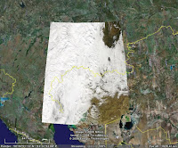
You can open one MODIS Terra image in GE and GMaps:
Open KMZ file in GE
Open KMZ file in GMaps
We see right result.

Structure KML+ relative path to image see best. For one image we can connect from many clients (GIS and image viewers). This construction now supported by GE (see example of KML and image) and not supported by GMaps. GMaps support absolute path only. Maybe next version of GMaps can use KML+image construction with relative path.


GMail+Calendar

GMail also support Calendar functions.
You can:
1. Press "Add event info" in top right angle of GMail box
2. Insert link to KML or KMZ file in field "Where"
3. Add time of event and other information.
4. Send this "geo event" to friends.
Your friends can add this event into Calendar, open KML in GE or GMaps.

Enjoy!

PS Also see test Calendar with "geo events" in Googlepages