7/30/2008

KML2KML v2.4.5


New features:
- export/import GPX (GPS) files
- KML to 3D Z calculator
- new context menu
- custom levels of altitudes in Get terrain module

Home page
Download

7/27/2008

Hyperlink in name of placemark

View in Google Earth

We can generate placemark directly by click on Name
This KML don't have coordinates.

1. Open KML
2. Click on name
3. See new generated placemark

KML2KML v2.4.3

Interface is improved
Paste KML from GE to KML explorer in release
Open KML by double click in KML explorer is added
Home page
Download

Buy It

7/25/2008

KML2KML v2.4.2. New features and interface

Main window
Add from URL, history of calls is added


Tools menu


Get terrain window. Aspect, Slope and Slope units is added (Plus and Pro)


Export menu
Export from KML (KMZ) to shp file is added (Plus and Pro)


Import window
Import from shp file to KML (KMZ) is added (Plus and Pro)


New tool Vertical transformation is added


KML to 3D window (Plus and Pro). Calculation of Slope and Aspect along of profile is added.
Legend and styles is added.


Home page
Download

7/24/2008

KML2KML v2.4.2

KML2KML new features:
Import-Export Shp files (for now WGS 84 only)
Example of historical photo collection (points only)
Import from shp > Reorganize (folders) > Region

See also http://gisplanet.blogspot.com/2008/04/yukon-geologic-maps.html
Credits: http://www.nrcan-rncan.gc.ca/com/index-eng.php

Home page http://xbbster.googlepages.com/kml2kml


View in Google Earth

7/16/2008

MapWiki v3.0 in Action

Chris Glazier, Valery Hronusov

New page http://villagegis.com/clients/syracuse/syracuse_PI.html is available.

Public input can be tracked using Google based mashups and GEmap. This page can be used by users that are "Logged In" or Anonymous Users, and data can be monitored and maintained by application administrators. The display is fast and easy to use. Events are categorized and placed by pulldown menus and custom icons. Web users can see placemarks, categorized by type and all events are assigned to a unique city domain in the database. Time animated KMLs can be generated from displayed data and sent to Google Earth.
Commuters, residents, officials, tourists, businesses, and others can add his placemarks (points, lines, polygons) along with event info. A Time stamp is automatically added and can be display in KML time-animation in Google Earth. The Map display can be changed to use Map, Satellite, Earth 3D mode functions (with GE plugin).

Mayors and City Councils can track, visualize and display information concerning community complaints, comments or concerns, with user contact information or without. Data can be retrieved via GeoRSS Feed.

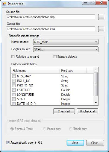
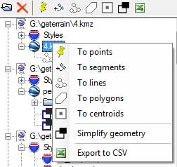
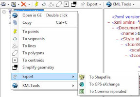
Administration accounts can upload KML data as an overlay. Data from our maps also can be used as KML overlay. New functionality with the ability to upload multiple KMLs and joins is anticipated. We can join cities maps into level of state.
There is a very large potential for this web functionality as Public Input is often a major factor in the success of Regional Development or Transportation Projects. Public opinions require tracking and analysis for assuring best outcomes and acceptance.
Example of a primary map (city)
Syracuse
ADACGRFPCEPRPZSTWSOT
Permalink: http://gemap.appspot.com/index.html?k=agVnZW1hcHILCxIEQ2l0eRigCQw
RSS: RSShttp://gemap.appspot.com/RSS?k=agVnZW1hcHILCxIEQ2l0eRigCQw
KML: http://gemap.appspot.com/DB2KML?k=agVnZW1hcHILCxIEQ2l0eRigCQw

Edit mode is available

This mapwiki is also available as Gadget to IPhone users and iGoogle environment. You can add this gadget into spreadsheets or pages.

Our site for testing and development http://sites.geoblogspot.com/mapwiki/

List of maps is available. You can see difference set of icons, topics. Difference languages is supported.
We can include KML feed from one map into other maps.
As example:
Utah map = North Ogden map + Salt Lake City map + Syracuse map
KML data to Utah from cities added automatically.

Example of user defined icons, language and topics you can see in Perm map (Russia)

7/15/2008

KML2KML v2.3.1

KML2KML v2.3.1 in release
New features:
Slope calculation is added
Aspect calculation is added


Example 1

View in Google Earth
This KML store next examples of KML2KML features:
- profiles (source)
- convert profiles to segments
- convert profiles to points
- convert segments to 3D by GE terrain
- convert points to 3D by GE terrain


Example 2
View in Google Earth
Ural mountains. Basegi.
Colored by altitude


View in Google Earth
KML2KML. To segments + KML to 3D
Simple my sign


Example 3
Terrikon. SKRU-2 Salt mines.

Altitude
View in Google Earth


Slope View in Google Earth


Aspect
View in Google Earth


7/12/2008

Mapwiki 3.0

Mapwiki v.3

New features:
- App engine, django, database
- new site of maps
- custom set of topics
- multilanguages
- KML, GeoRSS, permalink, gadget for every maps
List of maps (for testing only):
http://gemap.appspot.com/ListOfMap.html

View in Google Earth

7/07/2008

KML2KML. Mountains and reservoirs.

KML2KML

Chickamauga Reservoir.


Chickamauga Reservoir is on the Tennessee River just north of Chattanooga. The reservoir stretches 59 miles upriver from the dam to Watts Bar Dam.
Credits: http://www.tva.gov/sites/chickamauga.htm
Vertical scale 10:1
View in Google Earth - 3D model (points, contours, wireframe, surface)
View in Google Earth - profiles

Ural mountains. Basegi.


Vertical scale 10:1
View in Google Earth

Ural mountains. Oslyanka
Grid 100x100 nodes
Vertical scale 10:1


View in Google Earth