10/30/2007

Using KML in Google Mashup Editor

via http://googlemapsapi.blogspot.com/2007/10/kml-articles-abound-its-about-time.html

Introduction.

Google Mashup Editor (GME) is one of the most long-awaited and useful tools for mashup developers. GME helps developers create and edit dynamic components in Web pages, such as maps, tables, lists, and other elements, based on connections with external data. These elements can be then be included in Web pages and blogs using an iframe.

This tutorial will show you how to incorporate a KML file into a Map created with GME.


My first impressions of Google Mashup Editor

  • It has the utmost simplicity, with a clean and distinct interface, like the majority of Google products.
  • It has a convenient project index with a constantly increasing collection of code examples, as well as the author's code.
  • It allows for the easy storage of additional resources to the project (such as image files).
  • It has an easy-to-use XML debugger.
  • It has lots of easy-to-use sample applications.

GME for KML Developers

Before the advent of the Internet, spatial data was traditionally difficult to share. However, with the development of the Internet, mapping applications became a standard way of easily sharing Geographic Information Systems (GIS) data with the world. KML is becoming a standard for the presentation and interchange of GIS data because it is compact, easy to develop, and is supported by popular applications such as Google Earth and Google Maps.

Until recently, the process of creating and editing pages based on JavaScript was a large problem for KML developers. It required a large number of additional steps to create a mashup and debug it. GME makes it possible to create a KML-based mashup very rapidly out of a few basic components. The process of creation does not require special knowledge of HTML or JavaScript. The GME sample projects provide enough to get started.

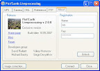
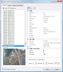
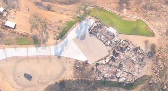
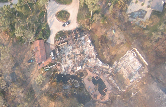
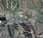
In the following example, I'll be using a KML file that points to the collection of the photographs taken during Pict Earth USA flights.

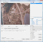
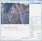
This is a snapshot of the Pict Earth maps mashup:
Pict Earth mashup snapshot

Click here to read more!

10/28/2007

San Diego fires. Pict Earth missions.

Pict'Earth 2007 San Diego Wildfire Data

Pict'Earth Adv Processing applied with Canon SD110 to create Google Earth files


Poway, California

LOW Resolution kmz file 5MB
HIGH Resolution kmz file - superoverlay


Rancho Santa Fe, California

LOW Resolution kmz file 5MB
HIGH Resolution kmz file - superoverlay

More info about current PE missions you can see:
http://pictearth.com/
http://pictearth.com/2007sdfires.html

GEB by Frank Taylor:
http://www.gearthblog.com/blog/archives/2007/10/uav_photos_of_burned_areas_in_san_d.html

Our social network:
http://pictearth.ning.com/

AGU 2007

Links

Pict'Earth
http://pictearth.com

Pict'Earth: A new Method of Virtual Globe Data Acquisition


  • Date: Wed, 12th Dec
  • Time: 1:40pm
  • Location: Poster Hall

Authors

Jeffrey Johnson (presenter)
Pict'Earth Imaging Systems USA, 319 S. Ditmar #1, Oceanside, CA 92054, United States

Stewart Long
Pict'Earth Imaging Systems USA, 319 S. Ditmar #1, Oceanside, CA 92054, United States

David Riallant
Pict'Earth Imaging Systems Europe, 4 mas courbier route de noves, St Remy de Provence, 13 13210, France

Valery Hronusov
Dept. of the Egineering Geology, Perm State University, Perm, Genkelya 4, Perm State University, Perm 614990, Russian Federation


Abstract

Georeferenced aerial imagery facilitates and enhances Earth science investigations. The realized value of imagery as a tool is measured from the spatial, temporal and radiometric resolution of the imagery. Currently, there is an need for a system which facilitates the rapid acquisition and distribution of high-resolution aerial earth images of localized areas. The Pict'Earth group has developed an apparatus and software algorithms which facilitate such tasks. Hardware includes a small radio-controlled model airplane (RC UAV); Light smartphones with high resolution cameras (Nokia NSeries Devices); and a GPS connected to the smartphone via the bluetooth protocol, or GPS-equipped phone. Software includes python code which controls the functions of the smartphone and GPS to acquire data in-flight; Online Virtual Globe applications including Google Earth, AJAX/Web2.0 technologies and services; APIs and libraries for developers, all of which are based on open XML-based GIS data standards. This new process for acquisition and distribution of high-resolution aerial earth images includes the following stages: Perform Survey over area of interest (AOI) with the RC UAV (Mobile Liveprocessing). In real-time our software collects images from the smartphone camera and positional data (latitude, longitude, altitude and heading) from the GPS. The software then calculates the earth footprint (geoprint) of each image and creates KML files which incorporate the georeferenced images and tracks of UAV. Optionally, it is possible to send the data in-flight via SMS/MMS (text and multimedia messages), or cellular internet networks via FTP. In Post processing the images are filtered, transformed, and assembled into a orthorectified image mosaic. The final mosaic is then cut into tiles and uploaded as a user ready product to web servers in kml format for use in Virtual Globes and other GIS applications. The obtained images and resultant data have high spatial resolution, can be updated in near-real time (high temporal resolution), and provide current radiance values (which is important for seasonal work). The final mosaics can also be assembled into time-lapse sequences and presented temporally. The suggested solution is cost effective when compared to the alternative methods of acquiring similar imagery. The systems are compact, mobile, and do not require a substantial amount of auxiliary equipment. Ongoing development of the software makes it possible to adapt the technology to different platforms, smartphones, sensors, and types of data. The range of application of this technology potentially covers a large part of the spectrum of Earth sciences including the calibration and validation of high-resolution satellite-derived products. These systems are currently being used for monitoring of dynamic land and water surface processes, and can be used for reconnaissance when locating and establishing field measurement sites.

AGU links:

10/15/2007

Pict Earth software. Superoverlays. Cessna mission.

Pict Earth software. Superoverlays. Cessna mission.
Results. Liveprocessing > Postprocessing > Image corrector > Superoverlay > S3 publication


View in Google Earth

Pict Earth software. Liveprocessing. Beta 2.

Pict Earth software. Live processing. Beta 2.
Contacts


Live processing. GPS options.


Live processing. Camera parameters.


Live processing. Preference.


Live processing. KML options.


Live processing. About. Pict Earth account.


Live processing. Mission.


Live processing. Cameras processing.


Live processing. Real time settings.

10/14/2007

Pict Earth software. Postprocessing. Beta 2.

Pict Earth software. Postprocessing & Image Corrector. Beta 2.
Contacts


Postprocessing. List of images. Time offset settings. Exif explorer. Drag&Drop.


Postprocessing. GPS track. Drag&Drop.


Postprocessing. Parameters.


Image corrector. Distortion. In. Preview from Postprocessing.


Image corrector. Distortion. Out. Preview from Postprocessing.

10/06/2007

KMLer 2.0.8

KMLer is the ArcGIS 9x extension for professional work with Google Earth.

Download

Version 2.0.8
Build: 17.09.2007
- Description field is added at kml/kmz importing
- Small bug's fixed