Pict'Earth 2007 San Diego Wildfire Data
Pict'Earth Adv Processing applied with Canon SD110 to create Google Earth files
Poway, California
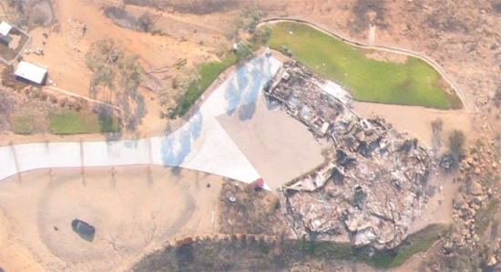
LOW Resolution kmz file 5MB
HIGH Resolution kmz file - superoverlay
Rancho Santa Fe, California
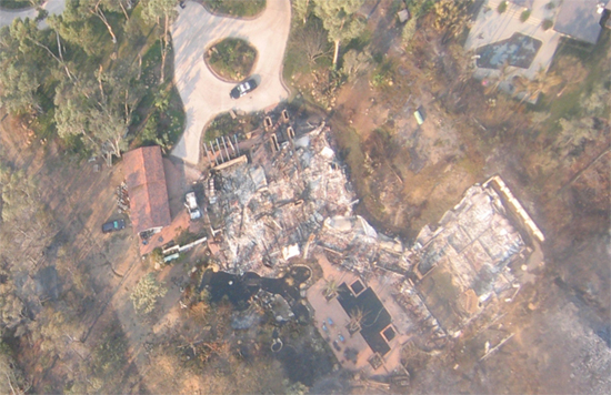
LOW Resolution kmz file 5MB
HIGH Resolution kmz file - superoverlay
More info about current PE missions you can see:
http://pictearth.com/
http://pictearth.com/2007sdfires.html
GEB by Frank Taylor:
http://www.gearthblog.com/blog/archives/2007/10/uav_photos_of_burned_areas_in_san_d.html
Our social network:
http://pictearth.ning.com/
No comments:
Post a Comment