Download
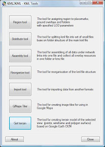
KML Tools
Toolbar. List of modules.
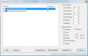
Region tools
Tools for assigning region to placemarks, groundoverlays and folders with specifided LOD parameters. Very often you have large vector kml data that is loaded in GE. To load your data more optimum it is necessary to specify regions and levels of detail (LOD) for each object or for group of objects. ‘Region tool’ solve this problem. This tool opens your kml/kmz data, calculates extents for each object or group of objects, according the options you specified and stores ‘Region’ and ‘Lod’ tags in your kml/kmz file.GE Sky mode is supported. For more info about Region and LOD in KML see official GE help.
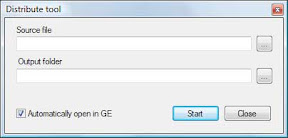
Distridute tools
The tool for splitting KML file into set of small filesbase on folder structure of the main KML file.
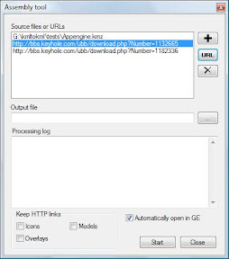
Assembly tools
Assembly is the tools fof assembling of all data under network links into one and collect all overlay resources in one folder or KMZ file. We can use result for desktop (enterprise) solution without internet.
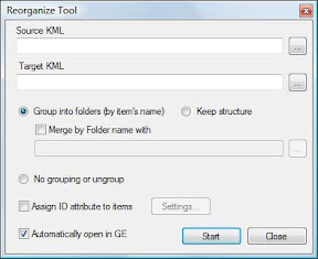
Reorganize tools
The tools for reorganization of the KML file structure
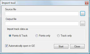
Import tools
The tools for importing data from other (GPS) formats (NMEA, GPX)
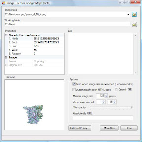
GMaps tiler
The tool for create image tiles for using in Google Maps
Get Terrain - Plus version (in beta)
The tool for creating terrain model of the selected view (points, wireframe and polygon surface) based on GEarth DEM

1 comment:
OPA
Post a Comment