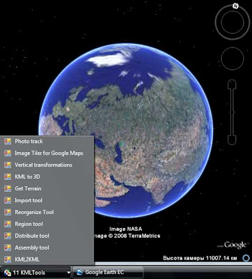
New home page.
Application list.
Stand alone applications

KML2KML
KML2KML is an application including tools for reorganization and optimization of your kml/kmz data. ($) GE Sky mode is supported.Superoverlay
Superoverlay is a stand-alone Google Earth application for tiling raster datasets and creating view based regions in KML or KMZ groundoverlay files ($) GE Sky mode is supported.S3 explorer
S3 explorer is a stand-alone application for of files operations in Amazon S3 service (FREE).ArcGIS extensions
KMLer
KMLer Professional work with Google Earth from ArcGIS ($ and FREE functions)TypeConvert
TypeConvert Convert one feature class type to another (FREE)Geoselect
Geoselect collects data sources of the current active project to one folder in the specified format, adapts the project (mxd) to the new data, checks of duplicates, projects all layers to uniform coordinate system of the project (reproject) and preserves relative paths ($)Isoliner
Isoliner make grids and points theme with interpolate by Kriging's, triangulation and density methods ($ and FREE functions)Slice 3D
Slice 3D create of slices by an arbitrary profile line. Slice 3D is intended for making of information geological-geophysical model of a rock mass ($ and FREE functions)Download
Buy It
Geoprocessing enhanced model

Note
All extensions work with ArcGIS 9.1 and 9.2 version and use Net 2.0. Additional info about deployment see on Deployment and requirementsUnsupported
Argos tools (unsupported)
Web services
Spreadsheets - Spreadsheets KML solutions
Unsupported services
Mapwiki - gadget
MapWiki2 - geocommunity
No comments:
Post a Comment