Geoselect collects data sources of the current active project to one folder in the specified format, adapts the project (mxd) to the new data, checks of duplicates, projects all layers to uniform coordinate system of the project (reproject) and preserves relative paths
Download Geoselect for ArcGIS 10 DownloadGeoselect for ArcGIS 9.3
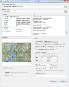
Superoverlay is a stand-alone Google Earth application for tiling raster datasets and creating view based regions in KML or KMZ groundoverlay files GE Sky mode is supported.


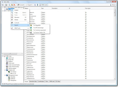
 KMLer Professional work with Google Earth from ArcGIS