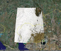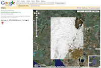

We can use one images dataset for groundoverlays in GE and GMaps.
Example:
I use WGS-84 projection. For work need embed image into KMZ file.
You can open one MODIS Terra image in GE and GMaps:
Open KMZ file in GE
Open KMZ file in GMaps
We see right result.
Structure KML+ relative path to image see best. For one image we can connect from many clients (GIS and image viewers). This construction now supported by GE (see example of KML and image) and not supported by GMaps. GMaps support absolute path only. Maybe next version of GMaps can use KML+image construction with relative path.
No comments:
Post a Comment